Isaias Strengthens in the Gulf as Hurricane Threat Grows, Florida Declares Emergency in 25 Counties
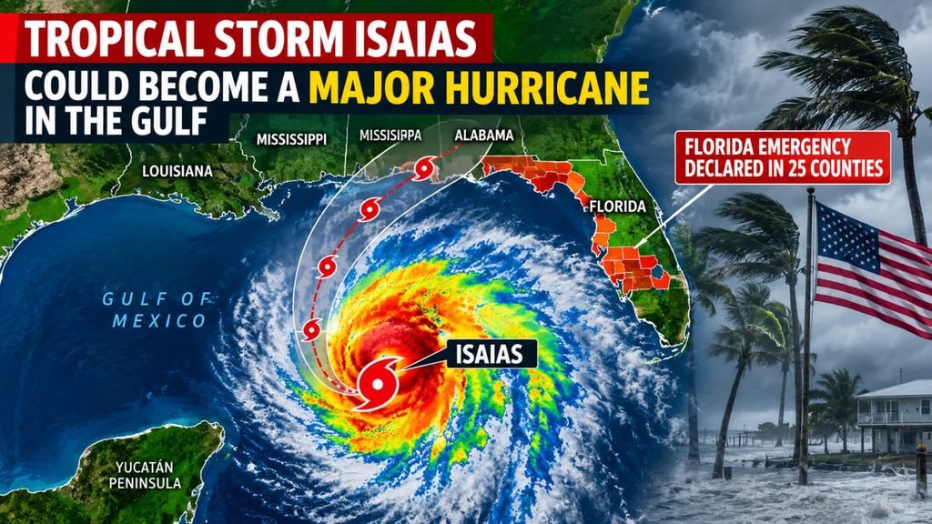
Isaias Strengthens in the Gulf: Hurricane Expected as Florida Declares Emergency Across 25 Counties
Isaias formed in the southwestern Gulf early Wednesday, and meteorologists believe it could turn into a hurricane within roughly a day. The northern Gulf Coast is currently in its path, with arrival expected near the end of the week. Florida Governor Ron DeSantis has already declared a state of emergency for 25 counties.
The naming
Some headlines called the system “Tropical Depression Nine,” while others used “Isaias.” Both were accurate, since the label simply changed over time. On Wednesday morning the depression reached tropical storm strength and was named Isaias, the ninth named storm of the 2026 Atlantic season.
At this point the storm is modest: maximum sustained winds are about 40 mph. Its center lies around 580 to 600 miles south of the Mississippi River’s mouth and is moving east-northeast at roughly 8 mph. The concern is how fast it may grow. The National Hurricane Center expects quick intensification over the next one to two days, noting that the storm is compact and sits in a favorable environment. If it hits hurricane strength on Thursday, it will be the first hurricane of the season.
The expected path
On Thursday the storm should stay over the southern Gulf, passing just north of Mexico’s Yucatán Peninsula and bringing heavy rainfall there. Afterward, a strong trough in the jet stream is expected to pull it northward toward the U.S. coastline.
Forecasts disagree on its peak strength. CNN reported it could become a Category 2 hurricane with 110 mph winds late Thursday or early Friday, then ease slightly before landfall. Other outlets suggested anything from Category 1 to Category 2. The hurricane center says it is increasingly likely Isaias will be a significant hurricane at landfall.
Timing and location are also uncertain. One forecast has landfall late Friday or early Saturday between Biloxi, Mississippi, and Panama City, Florida. A later update from a Louisiana station shifted the track east, toward the Alabama–Mississippi border. Forecasters stress that both timing and intensity remain uncertain.
AccuWeather’s chief meteorologist sees a possibility of Category 3 strength over the central Gulf, which would make it a major hurricane. That is one expert’s scenario, not the official forecast.
Who is at risk
About 30 million people across Louisiana, Alabama, Mississippi and the Florida Panhandle fall within the area of expected impacts, facing heavy rain, damaging winds and coastal flooding. A Mississippi station said the state’s southern portion could see hurricane conditions as early as Friday afternoon.
Flooding from rain could prove the bigger danger. A Level 3 out of 4 flash flood risk covers the Mobile, Alabama, region and the Panhandle west of Panama City. NOAA’s Weather Prediction Center also flagged Friday flash flooding across parts of Louisiana, Mississippi, Alabama, Florida and Georgia, extending to southern Tennessee and the western Carolinas. AccuWeather projects storm surge of 6 to 10 feet over Alabama and the western Panhandle, with isolated areas reaching 15 feet.
In the Gulf, offshore oil companies are taking protective steps, CNN reported.
Florida’s preparations
DeSantis signed the order Tuesday night. His office says it allows the state’s emergency management division to position people and supplies ahead of the storm rather than afterward.
The 25 counties include Escambia, Santa Rosa, Okaloosa, Walton, Bay, Leon and Wakulla, with the full list in the governor’s order.
The State Emergency Response Team has begun stockpiling generators, fuel, flood barriers, drinking water, ready-to-eat meals, tarps and sandbags, sending them to Tallahassee and the Santa Rosa County area. DeSantis urged residents to make a disaster plan and keep their hurricane kits fully stocked.
What the order means
A declaration of emergency does not predict that any specific county will take a direct hit. It is an administrative step that lets crews and supplies move early, which matters a great deal with the storm only about two days away.
The track may still change, and a shift of even a few dozen miles could alter which areas face the worst surge and wind. Residents should follow the National Hurricane Center and their local emergency office, and obey any evacuation instructions.
The impact will also reach beyond the coast. Disruptions to Gulf energy production, port operations and inland flooding could affect the wider national economy. Still, as of the latest reports Isaias had not yet become a hurricane, and its final strength and landfall location remain forecasts.